Digging into the Past with QGIS: A Free Tool for Archaeologists
Unearthing the secrets of the past just got a little more digital! QGIS, a free and open-source Geographic Information System (GIS), is becoming a powerful ally for archaeologists. But what exactly can it do?
Imagine a program that lets you:
- Map your finds: Plot excavation sites, artefacts, and features with pinpoint accuracy.
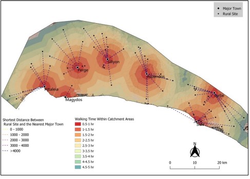
- See the bigger picture: Analyze distributions of artefacts across landscapes, helping you understand past settlements and trade routes.
- Uncover hidden patterns: Use spatial analysis tools to identify relationships between finds and environmental features.
- Share your discoveries: Create high-quality maps and reports to share your research with colleagues and the public.
QGIS goes beyond just maps. With a vibrant community developing plugins, you can:
- Process geophysical survey data: Analyze data from magnetometry, ground penetrating radar, and other techniques.
- Work with LiDAR: Explore detailed 3D models of excavation sites for a more complete picture.
- Visualize past landscapes: Reconstruct ancient environments and see how humans interacted with them.
Why QGIS?
- Free and open-source: No expensive licenses to worry about, making it accessible to everyone.
- User-friendly: Even beginners can get started with its intuitive interface and extensive tutorials.
- Highly customizable: Plugins let you tailor QGIS to your specific archaeological needs.
- Powerful for analysis: Packed with tools for spatial analysis and data exploration.
Whether you’re a seasoned archaeologist or a curious student, QGIS can revolutionize the way you approach the past. So, ditch the paper and grab your digital shovel – it’s time to start digging into the world of QGIS!
