Category: 3D GIS
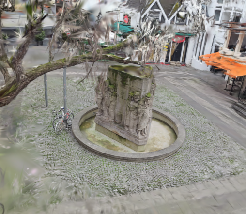
Cologne’s Monuments in 3D: Help Us Document History! We’re on a mission to create a stunning 3D record of Cologne’s monuments, entirely through a volunteer effort! We’ve already…
Maps with Leaflet Leaflet isn’t your average map maker. It’s a powerful JavaScript library that lets you build interactive maps that go beyond just showing locations. Imagine creating…
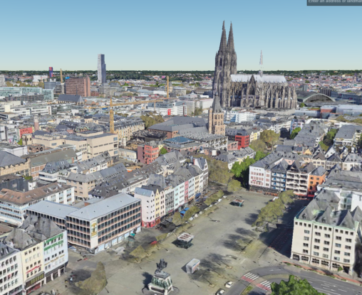
Explore Cologne’s Monuments in 3D! Dive into Cologne’s rich history and architecture from the comfort of your home with the “Project 3D Monumente”! This innovative project curates a…