
Article
Article
GeoAI in der öffentlichen Verwaltung
GeoAI in der öffentlichen Verwaltung GeoAI, also die Kombination von geografischen Informationssystemen (GIS) mit künstlicher Intelligenz (KI), bietet immense Möglichkeiten für die öffentliche Verwaltung. Diese...
5 min
Dec 2025

Article
Metadatenstandards im Kultursektor in Deutschland mit internationalem Vergleich
Metadatenstandards im Kultursektor in Deutschland mit internationalem Vergleich 1. Einleitung Metadatenstandards sind das Fundament der digitalen Kulturarbeit. Sie beschreiben, was ein Objekt, eine Quelle oder...
5 min
Dec 2025
Article
Vergleich deutscher Museumsdatenbanken hinsichtlich Zukunftssicherheit und AI-Fähigkeit
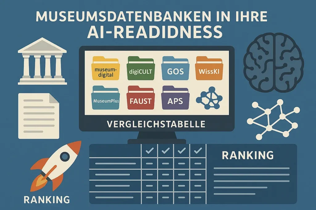
Vergleich deutscher Museumsdatenbanken hinsichtlich Zukunftssicherheit und AI-Fähigkeit Museen in Deutschland nutzen verschiedene Museumsdatenbanken für die Inventarisierung und Publikation ihrer Sammlungen. In dieser Analyse werden sieben bedeutende...
5 min
Dec 2025
Article
Digital Heritage LAB 3D GIS
Digital Heritage LAB 3D GIS: Erkunden Sie Denkmäler in 3D! Das Digital Heritage LAB 3D GIS ist eine WebGIS-Anwendung, die 3D-Modelle von Monumenten aus der...
5 min
Sep 2025
Article
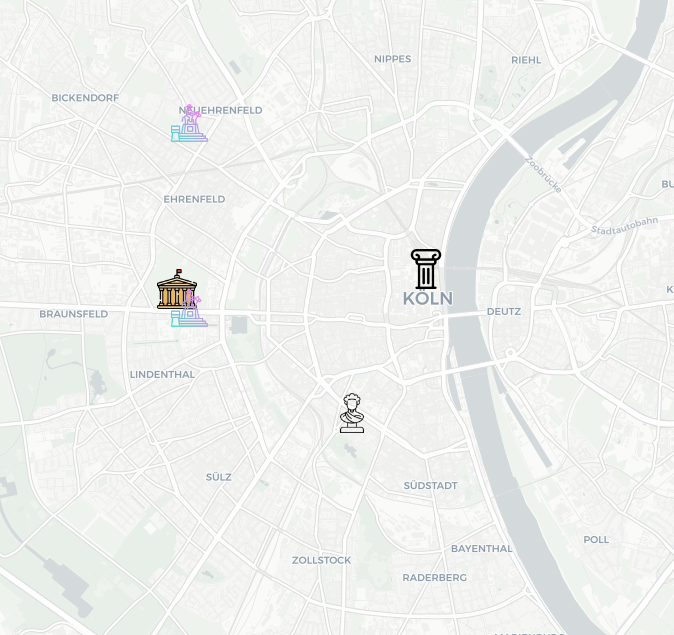
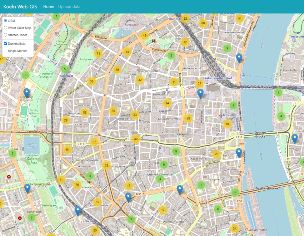
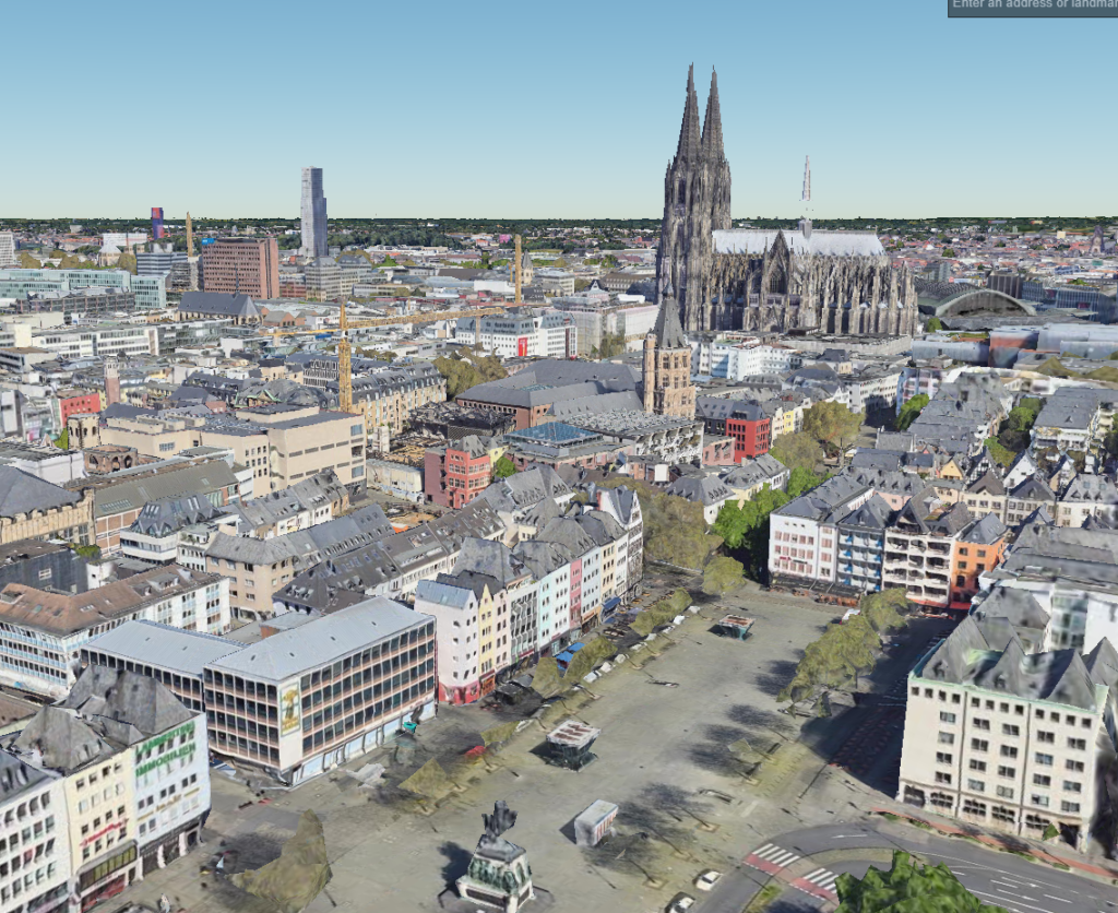
Map of the monuments City Cologne (Old Version)
Dive into Cologne’s rich past with an interactive map of its historic monuments! This project uses freely available open data to pinpoint these iconic landmarks,...
5 min
Sep 2025
Article
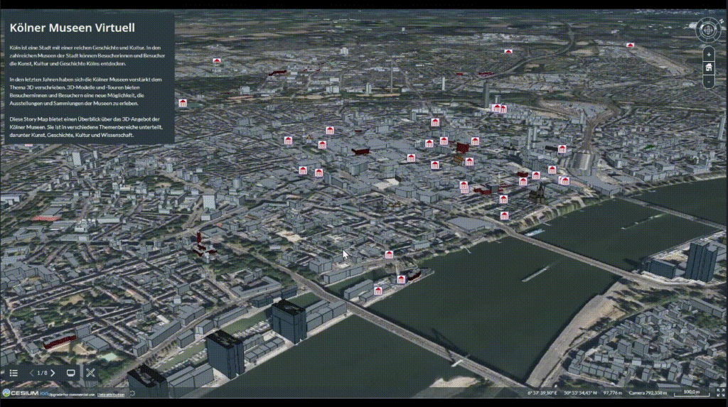
Virtuell Cologne City Museums (Storymap)
Cologne boasts magnificent museum collections alongside world-famous monuments nominated for World Heritage status. But what if the weather isn’t cooperating? Don’t worry! ☔️ This past...
5 min
Sep 2025
Article
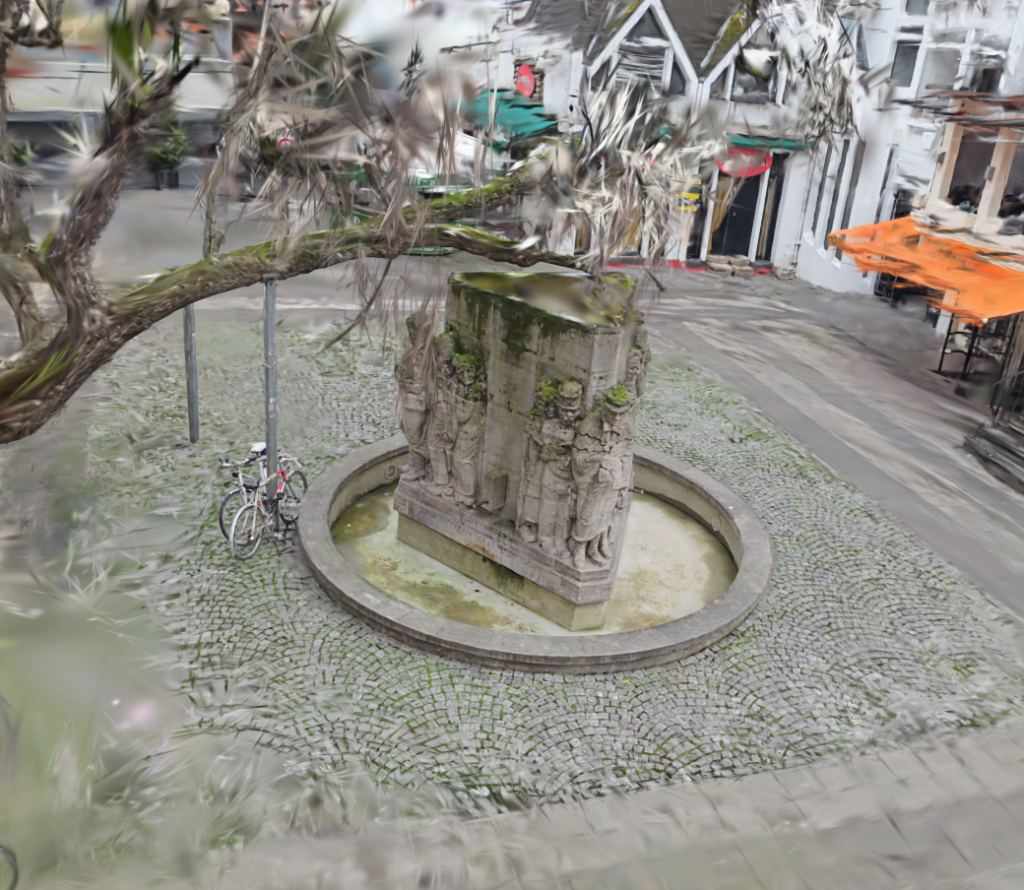
Cologne’s Monuments in 3D
Cologne’s Monuments in 3D: Help Us Document History! We’re on a mission to create a stunning 3D record of Cologne’s monuments, entirely through a volunteer...
5 min
Sep 2025

Article
Leaflet WebGIS for Archaeological Data (Malazgirt Project)
Maps with Leaflet Leaflet isn’t your average map maker. It’s a powerful JavaScript library that lets you build interactive maps that go beyond just showing...
5 min
Sep 2025
Article
QGIS for Archaeology
Digging into the Past with QGIS: A Free Tool for Archaeologists Unearthing the secrets of the past just got a little more digital! QGIS, a...
5 min
Sep 2025
Article
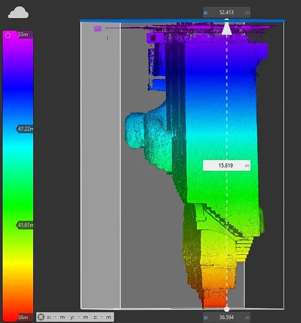
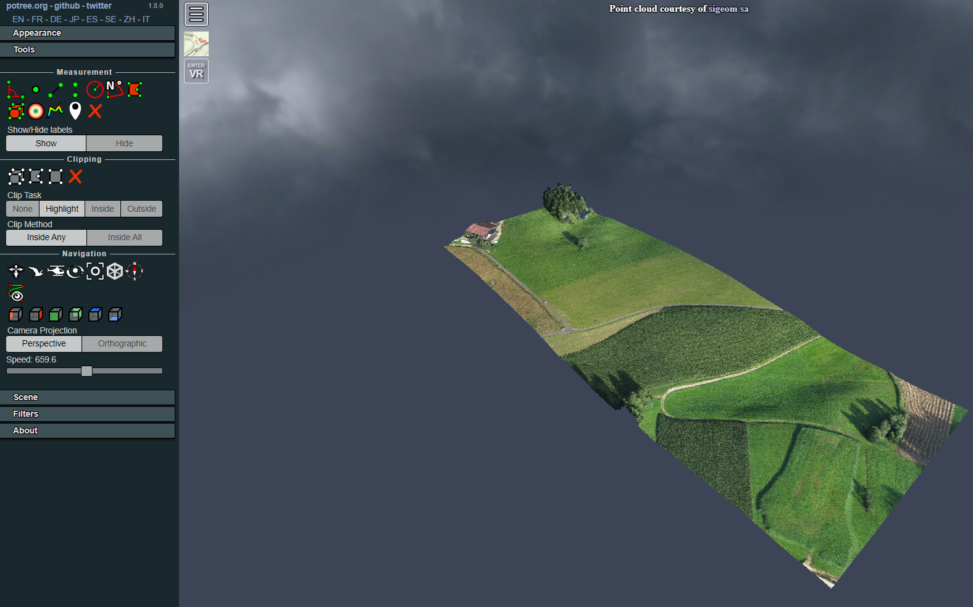
3D Point cloud Viewer
Potree to the Rescue! Struggling with bulky 3D point cloud data? Potree is your superhero! This free and open-source viewer tackles massive datasets, making them...
5 min
Sep 2025
Article
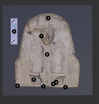
Kompakkt.de: Publishing of 3D Heritage Assets
Kompakkt.de is an open-source platform developed by the University of Cologne specifically for publishing 3D heritage assets. This means you can upload your 3D scans,...
5 min
Sep 2025
Article
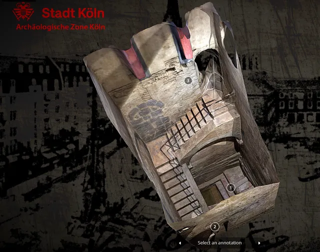
Project 3D Monumente of City Cologne
Project 3D Monumente of City Cologne Explore Cologne’s Monuments in 3D! Dive into Cologne’s rich history and architecture from the comfort of your home with...
5 min
Sep 2025
